What is the difference between a hurricane and a typhoon?
Short answer
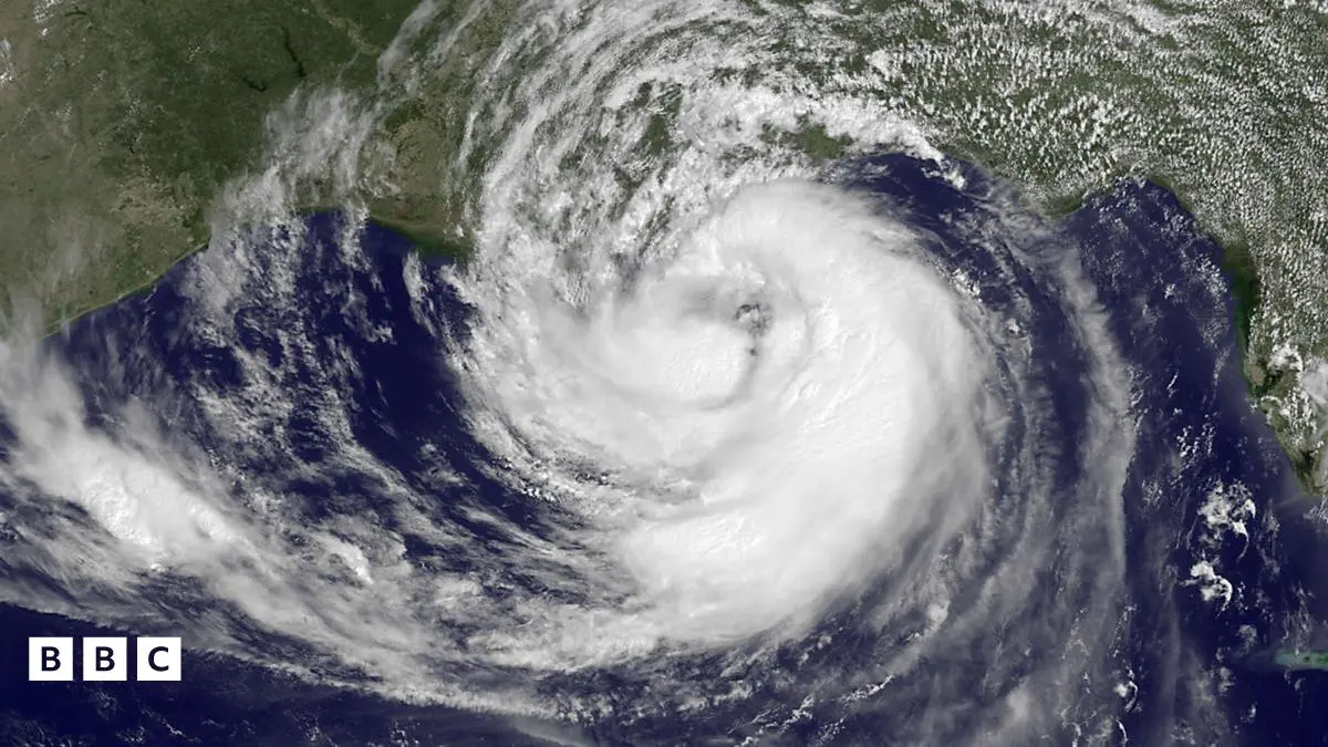
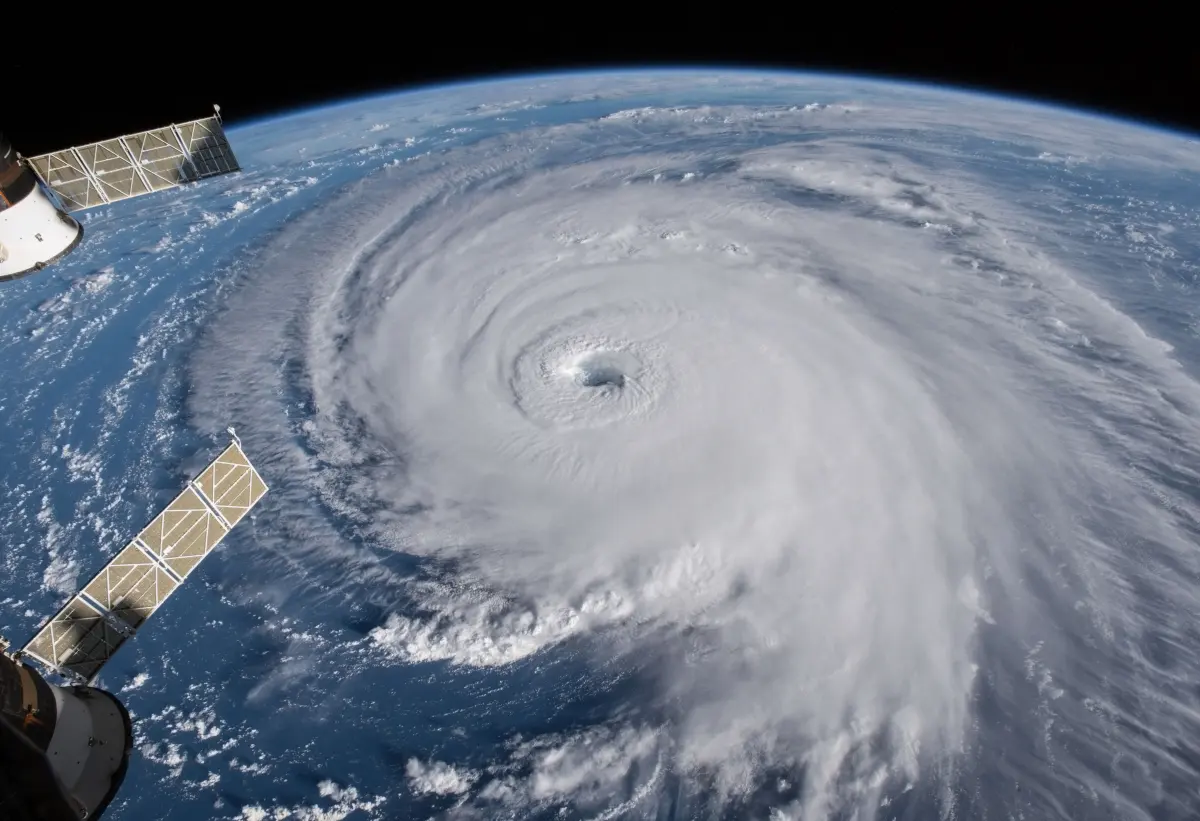
Hurricanes and typhoons are the same weather phenomenon: mature tropical cyclones. The only difference is their geographic location. Hurricanes occur in the North Atlantic and Northeast Pacific, while typhoons form in the Northwest Pacific. Both systems feature sustained winds of at least 74 miles per hour and rotate around a calm center.
On this page
Why do hurricanes and typhoons have different names?
The distinction between these storms is purely a matter of geography rather than physical characteristics. Meteorologists use specific terms based on the ocean basin where the tropical cyclone originates. This naming convention helps emergency management agencies and the public identify which regional weather center is responsible for tracking the storm and issuing official warnings.
While the underlying physics of these storms remains identical, the global community divides them into several distinct categories based on their location:
- Hurricanes: North Atlantic and Northeast Pacific (east of the International Date Line).
- Typhoons: Northwest Pacific (west of the International Date Line).
- Cyclones: South Pacific and Indian Ocean.
- Willy-willies: A colloquial, outdated term sometimes used in Australia.
Regardless of the name, all these storms are fueled by the same thermodynamic processes. They derive their energy from the latent heat released when moist air rises and condenses over warm tropical waters. Because they share this fundamental structure, a storm that crosses the International Date Line may technically change its name from a hurricane to a typhoon, even though the storm itself remains unchanged.
How do these storms form and strengthen?
Tropical cyclones require specific environmental conditions to develop and intensify. The most critical factor is a sea surface temperature of at least 80 degrees Fahrenheit (26.5 degrees Celsius). This warmth provides the necessary energy to fuel the storm's convective engine. Additionally, the atmosphere must have high humidity in the lower and middle levels to prevent the evaporation of clouds, which would otherwise weaken the system.
Another essential ingredient is low vertical wind shear. Wind shear refers to the change in wind speed or direction at different altitudes. If wind shear is too strong, it can tilt the storm's structure and disrupt the vertical alignment of the heat engine, effectively choking off the storm's power supply.
- Warm, moist air rises from the ocean surface, creating an area of low pressure below.
- Surrounding air rushes into this low-pressure area, warms, and rises in turn.
- As this air rises, the water vapor condenses into clouds and releases latent heat.
- This heat warms the surrounding air, causing it to rise faster and further lowering the surface pressure.
- The Coriolis effect, caused by the Earth's rotation, forces the air to spin, creating the characteristic cyclonic rotation.
What are the key differences in impact?
While the storms are physically the same, the impacts can vary significantly based on the geography of the affected regions. Typhoons in the Northwest Pacific often encounter large landmasses like Japan, the Philippines, and China. Because these regions are densely populated and have extensive coastal infrastructure, the potential for widespread damage is extremely high.
Hurricanes typically affect the Caribbean, the United States, and Mexico. These storms often track along the Gulf Stream, which can act as a conveyor belt for heat, allowing them to maintain strength even as they move into higher latitudes. The primary hazards for both storms are identical:
- Storm surge: The rise in sea level caused by strong winds pushing water toward the shore.
- Extreme rainfall: Leading to catastrophic inland flooding.
- High-velocity winds: Capable of destroying buildings and downing power lines.
- Flying debris: Often the leading cause of injury during the peak of the event.
Common mistakes when preparing for a storm
Many people underestimate the danger of a storm based solely on its category or name. A common mistake is focusing only on the wind speed while ignoring the threat of flooding. Historically, water-related hazards, including storm surge and freshwater flooding, account for the vast majority of fatalities in both hurricane and typhoon events.
Another frequent error is the failure to evacuate when ordered. Residents often believe they can "ride out" the storm because they have survived previous events. However, every storm is unique in its path, intensity, and tidal timing. Relying on past experiences can lead to a false sense of security. To stay safe, follow these guidelines:
- Identify your home's vulnerability to flooding and wind.
- Create a comprehensive emergency kit with at least three days of food and water.
- Establish a communication plan with family members before the storm arrives.
- Monitor official updates from local meteorological agencies rather than social media rumors.
- Secure outdoor furniture and loose objects that could become projectiles in high winds.
How to track and monitor storm progress
Modern meteorology uses advanced satellite imagery, reconnaissance aircraft, and computer modeling to track these systems with high precision. Agencies like the National Hurricane Center in the United States and the Japan Meteorological Agency provide real-time data on storm paths. Understanding these forecasts is vital for making informed safety decisions during the tropical cyclone season.
When monitoring a storm, pay close attention to the "cone of uncertainty." This graphic represents the probable track of the center of the storm, but it does not indicate the size of the storm itself. The impacts, such as heavy rain and tropical-storm-force winds, often extend far outside the cone. Never assume that being outside the cone means you are safe from the storm's effects. Instead, focus on the specific watches and warnings issued for your exact location, as these are tailored to the immediate risks in your area. By staying informed through reliable, official channels, you can better prepare for the potential arrival of these powerful weather systems.
Key facts
- Hurricanes and typhoons are the same weather phenomenon, scientifically classified as tropical cyclones.
- The difference in name is determined solely by the geographic location where the storm occurs.
- Hurricanes form in the North Atlantic, central North Pacific, and eastern North Pacific oceans.
- Typhoons occur in the Northwest Pacific, typically affecting countries like Japan, China, and the Philippines.
- Cyclones in the South Pacific and Indian Ocean are simply referred to as tropical cyclones.
- All these storms require warm ocean waters of at least 80°F (26.5°C) to develop and sustain their energy.
The bottom line
The distinction between hurricanes and typhoons is purely geographical rather than meteorological. While they share the same physical characteristics, destructive potential, and formation requirements, the labels serve to help international agencies track storms by region. Regardless of the specific name used in your local area, these systems represent significant threats that require consistent monitoring, preparation, and strict adherence to official safety protocols during the season.
People also ask
Are typhoons more powerful than hurricanes?
No, the intensity is measured by the same criteria, such as wind speed and central pressure, regardless of the name. A Category 5 hurricane has the same destructive potential as a "super typhoon" of equivalent wind speed.
What is the difference between a tropical cyclone and a tropical depression?
A tropical depression is an organized system of clouds and thunderstorms with maximum sustained winds of less than 39 mph. Once sustained winds reach 74 mph, the system is upgraded to a hurricane or typhoon.
How do meteorologists name these storms?
Regional bodies, such as the World Meteorological Organization, maintain pre-determined lists of names for each basin. Names are rotated on a multi-year cycle and retired if a storm is particularly deadly or costly.
Can a single storm be both a hurricane and a typhoon?
Yes, if a storm crosses the International Date Line, its name and classification change. For example, a hurricane moving from the Central Pacific into the Northwest Pacific would be reclassified as a typhoon.
What is the "eye" of the storm?
The eye is a calm, relatively clear area at the center of a mature tropical cyclone. It is surrounded by the eyewall, which contains the storm's most intense winds and heaviest rainfall.
How should I prepare for a tropical cyclone?
Create an emergency kit with non-perishable food, water, and batteries, and identify your nearest evacuation route. Always follow official guidance from local authorities rather than relying on social media rumors during an active event.
This answer was created with the help of AI research tools and reference sources. Spotted an error? Let us know — we correct mistakes quickly. See our editorial policy.