How big is Canada?
Short answer
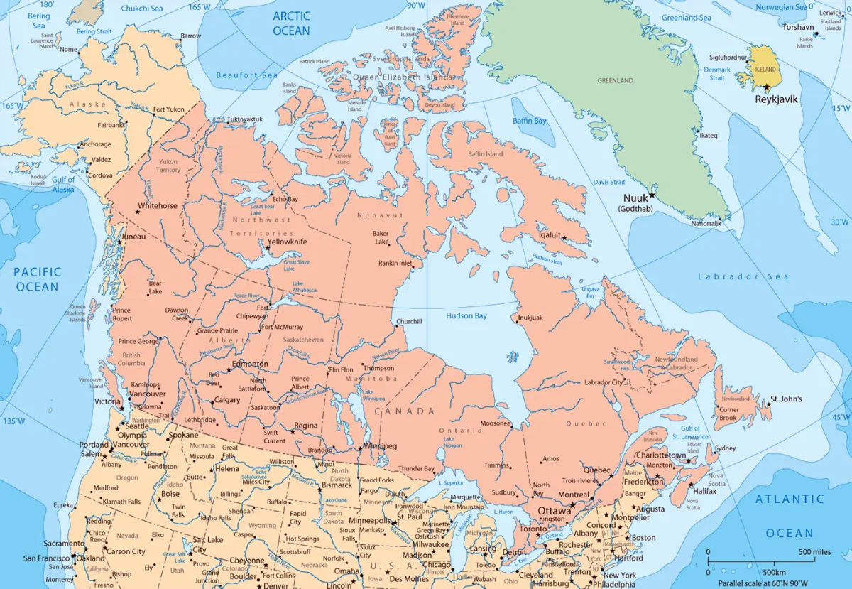
Canada covers approximately 9.98 million square kilometers, making it the second-largest country in the world by total area. It spans nearly 10 million square kilometers, stretching from the Atlantic Ocean in the east to the Pacific in the west, and north to the Arctic Ocean, encompassing diverse landscapes across its vast territory.
On this page
How big is Canada in square kilometers?
Canada occupies a massive portion of the North American continent, totaling 9,984,670 square kilometers. This figure includes both land area and freshwater bodies, which are exceptionally abundant in the country. In fact, Canada holds a significant percentage of the world’s total surface freshwater, with more lakes than the rest of the world combined.
To put this vast size into perspective, consider these comparisons:
- Canada is roughly 40 times the size of the United Kingdom.
- It is slightly larger than the entire continent of Europe.
- The country covers approximately 6.7 percent of the Earth's total land area.
- Its coastline is the longest in the world, measuring 243,042 kilometers.
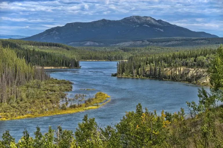
The sheer scale of the nation means it spans six different time zones. From the easternmost point in Newfoundland to the western border of the Yukon, the geographic diversity ranges from temperate rainforests and fertile prairies to the rugged, frozen expanses of the Arctic archipelago.
How long does it take to drive across Canada?
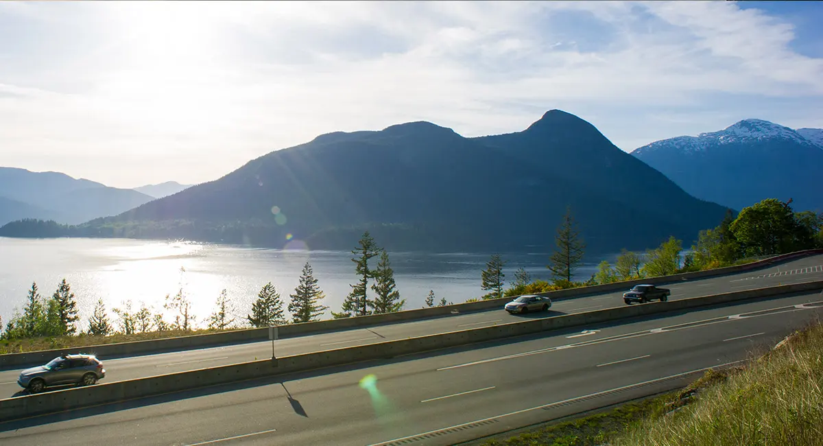
Driving across Canada is a monumental undertaking that requires careful planning and significant time. The Trans-Canada Highway, which connects the country from St. John’s, Newfoundland, to Victoria, British Columbia, spans approximately 7,821 kilometers. Under ideal conditions, a non-stop journey would take about 80 to 90 hours of pure driving time.
However, most travelers should plan for a much longer trip to account for safety and enjoyment. A realistic timeline for a cross-country road trip includes:
- Budgeting at least 10 to 14 days for a comfortable pace.
- Allowing for daily driving limits of 8 to 10 hours to avoid exhaustion.
- Scheduling extra days for weather delays, especially in mountain passes or during winter months.
- Factoring in time for ferry crossings, such as the journey from Newfoundland to the mainland.
Drivers should be aware that distances between service stations in northern regions or the prairies can be hundreds of kilometers. Always maintain a full tank of gas and carry emergency supplies.
Why is Canada so sparsely populated?
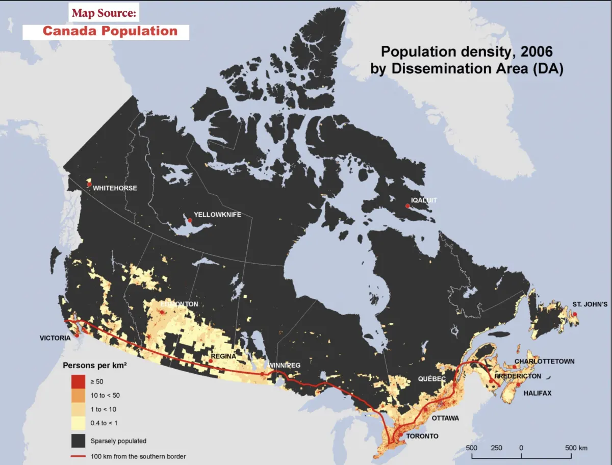
Despite its immense size, Canada has a relatively small population of approximately 41 million people. The primary reason for this low density is the country's harsh climate and challenging topography. Large portions of the northern territories consist of permafrost, rocky Canadian Shield, and mountainous terrain that are difficult to develop or sustain for large-scale urban living.
As a result, the vast majority of Canadians live within a narrow band near the southern border with the United States. This concentration is driven by:
- Access to more moderate climates and longer growing seasons.
- Proximity to major trade routes and international markets.
- Historical settlement patterns that favored the St. Lawrence River and Great Lakes regions.
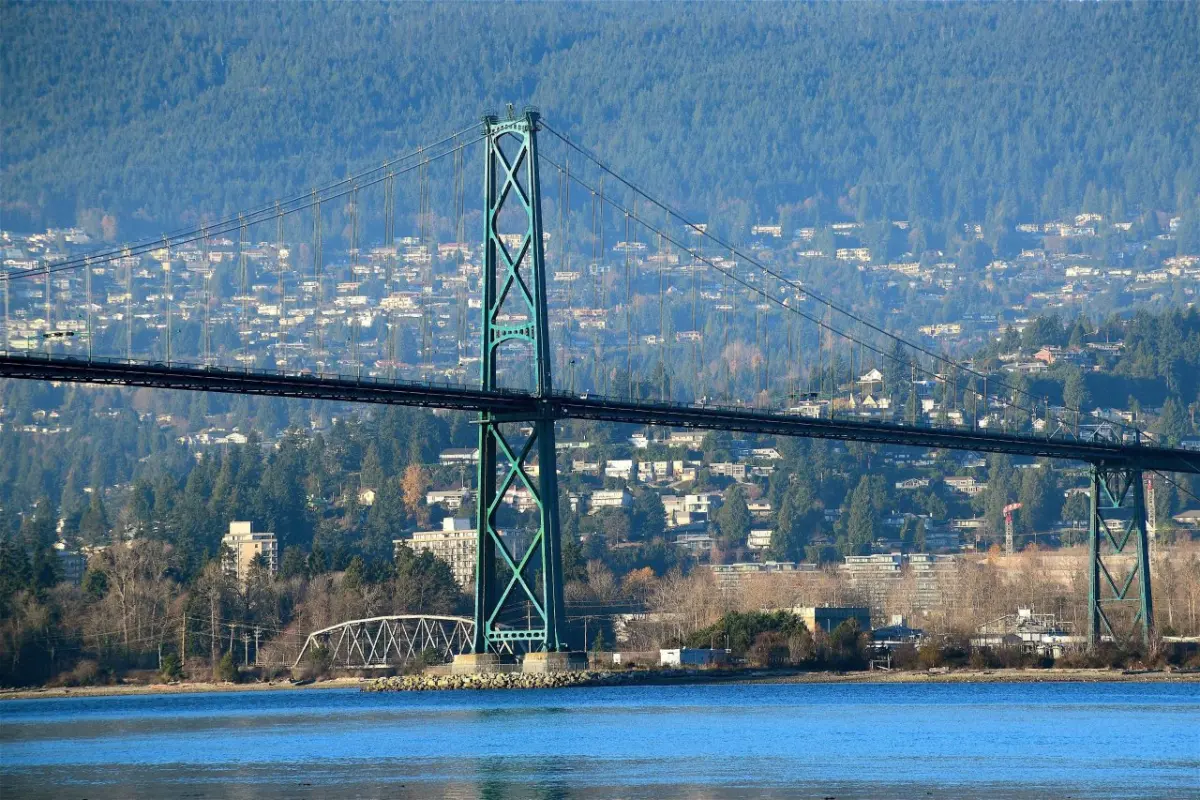
- The availability of infrastructure and established urban centers like Toronto, Montreal, and Vancouver.
While the north remains sparsely populated, it holds immense cultural significance and natural resources. The Indigenous peoples have inhabited these vast northern lands for thousands of years, maintaining deep connections to the environment despite the extreme conditions.
Common mistakes when planning travel in Canada
Many visitors underestimate the sheer scale of the country and the variability of its weather. A common error is attempting to visit multiple regions, such as the Rocky Mountains and the Atlantic coast, in a single week. Because the distance between these areas can be thousands of kilometers, travelers often spend more time in transit than actually experiencing their destinations.
To ensure your trip is successful, avoid these common pitfalls:
- Overestimating your daily driving capacity, especially on winding mountain roads.
- Ignoring regional weather forecasts, which can change rapidly regardless of the season.
- Forgetting to book accommodations in advance, particularly in popular national parks during peak summer months.
- Underestimating the cost of fuel and food in remote northern or rural communities.
- Failing to prepare for wildlife encounters, such as bears or moose, which are common on highways.
Always check local road conditions through provincial transportation websites before departing. Being prepared for the environment ensures a much safer and more enjoyable experience.
How do provinces and territories compare in size?
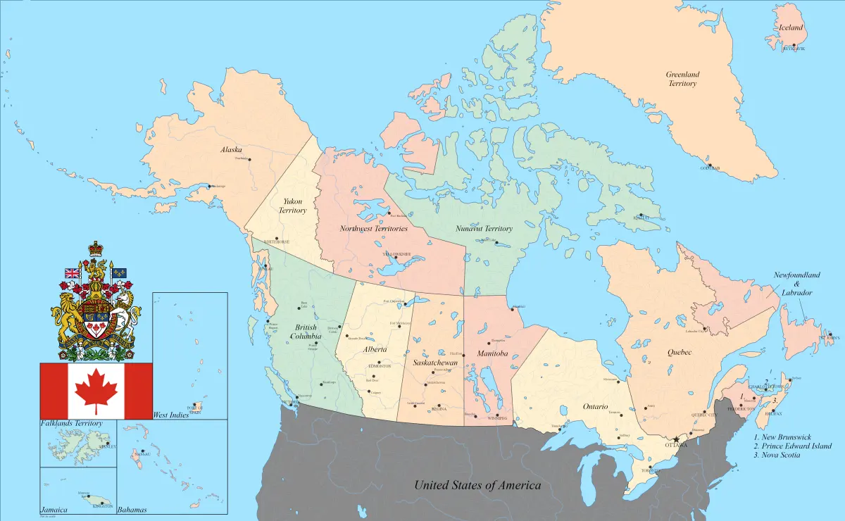
Canada is divided into ten provinces and three territories, each with distinct geographic characteristics. Nunavut is the largest, covering over 2 million square kilometers, yet it has the smallest population density. In contrast, Prince Edward Island is the smallest province, measuring only 5,660 square kilometers, but it is the most densely populated region in the country.
The administrative divisions are categorized by their unique roles:
- Provinces: These have their own governments and exercise constitutional powers in their own right.
- Territories: These are governed by the federal government but have delegated powers.
- The Canadian Shield: This massive geological formation covers much of Quebec, Ontario, and Manitoba, influencing the settlement patterns of these provinces.
Understanding these divisions helps travelers and researchers grasp how the country manages its resources and governance across such a massive, diverse landscape. Whether exploring the rocky coastlines of the east or the vast, tundra-covered plains of the north, the sheer scale of Canada remains its most defining and awe-inspiring feature.
Key facts
- Canada is the second-largest country in the world by total area, covering approximately 9.98 million square kilometers.
- The country spans six time zones, stretching from the Atlantic Ocean in the east to the Pacific Ocean in the west.
- Canada possesses the longest coastline of any nation, measuring roughly 243,042 kilometers along its shores.
- Approximately 9% of the country's total area is covered by freshwater, including more lakes than the rest of the world combined.
- To visualize the scale, driving across Canada from St. John’s, Newfoundland, to Victoria, British Columbia, covers about 7,500 kilometers.
- When planning a trip, avoid the mistake of underestimating travel time; flying between major cities like Toronto and Vancouver takes over five hours.
The bottom line
Canada’s vast geography is defined by its immense scale, stretching across nearly 10 million square kilometers. From its extensive freshwater resources to its diverse regional climates, the country offers unparalleled natural variety. Travelers should plan carefully, as the sheer distance between provinces requires significant time to navigate. Ultimately, Canada’s size is a defining feature that shapes its economy, environment, and the daily lives of its citizens.
People also ask
Does Canada have the most land area in the world?
No, Russia holds the title for the largest land area globally. Canada ranks second in total area, though it ranks fourth if considering only land mass because of its vast internal water bodies.
How many provinces and territories make up Canada?
Canada consists of ten provinces and three territories. Provinces have their own constitutional powers, while territories are delegated powers by the federal government.
Is it possible to drive across Canada in a few days?
While technically possible with multiple drivers, it is highly impractical and exhausting. A safe, enjoyable cross-country road trip typically requires at least two to three weeks to account for the massive distances.
Which Canadian province is the largest by land area?
Quebec is the largest province by total area, covering over 1.5 million square kilometers. Nunavut is the largest territory, encompassing a vast portion of the Canadian Arctic.
What percentage of Canada is inhabited?
Most of Canada's population is concentrated within 100 miles of the United States border. The vast northern regions remain sparsely populated due to harsh climate conditions and rugged terrain.
How does Canada’s size impact its climate?
The country's immense size creates extreme regional climate variations. You can experience humid continental weather in the east, temperate rainforests on the west coast, and arctic conditions in the north simultaneously.
This answer was created with the help of AI research tools and reference sources. Spotted an error? Let us know — we correct mistakes quickly. See our editorial policy.