What is the difference between a hill and a mountain?
Short answer
The primary difference between a hill and a mountain is elevation and topographical prominence. While there is no universal scientific standard, mountains are generally defined as landforms rising significantly above their surroundings, typically exceeding 2,000 feet in height, often featuring steep slopes and defined peaks. Hills are smaller, rounded, and lower elevations.
On this page
What defines a mountain versus a hill?
Geologists and geographers often struggle to define a strict threshold between these two landforms because the distinction is largely subjective and culturally dependent. In general, a mountain is characterized by its significant elevation above sea level and its prominence relative to the surrounding terrain. Mountains usually possess steep, rugged slopes and a distinct summit or peak. They are often formed through tectonic forces, such as the collision of continental plates or volcanic activity, which push the Earth's crust upward over millions of years.
Hills, by contrast, are elevated landforms that are lower and less steep than mountains. They are typically rounded in shape and lack the dramatic, jagged peaks associated with high-altitude ranges. While mountains are often part of larger, interconnected chains, hills can appear in isolation or as rolling clusters. In many regions, the local naming convention dictates the classification; a feature that is called a mountain in a flat, coastal area might be considered a mere hill if it were located near the Himalayas or the Andes.
How to distinguish landforms by height and slope
Because there is no global legal standard, different organizations use specific metrics to categorize landforms. The United Kingdom, for example, historically classified a mountain as any peak reaching at least 2,000 feet (610 meters). However, many modern geographers prefer to look at the "prominence" of a feature—the vertical distance between the peak and the lowest contour line encircling it—rather than just the elevation above sea level.
To differentiate these features in the field, consider the following characteristics:
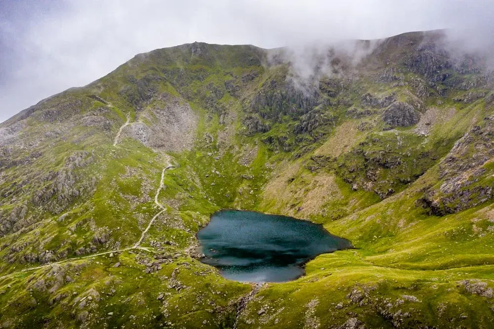
- Slope Angle: Mountains typically feature slopes exceeding 30 degrees, while hills are generally gentler.
- Vegetation: Mountains often exhibit distinct "life zones" where tree growth stops at the timberline, whereas hills are usually covered in vegetation from base to summit.
- Geological Origin: Mountains are frequently the result of intense folding, faulting, or volcanic uplift, whereas hills are often formed by the erosion of larger landforms or the accumulation of glacial debris.
- Climate: Mountains are high enough to influence local weather patterns, such as creating rain shadows, while hills rarely impact regional climate systems.
Why elevation is not the only factor
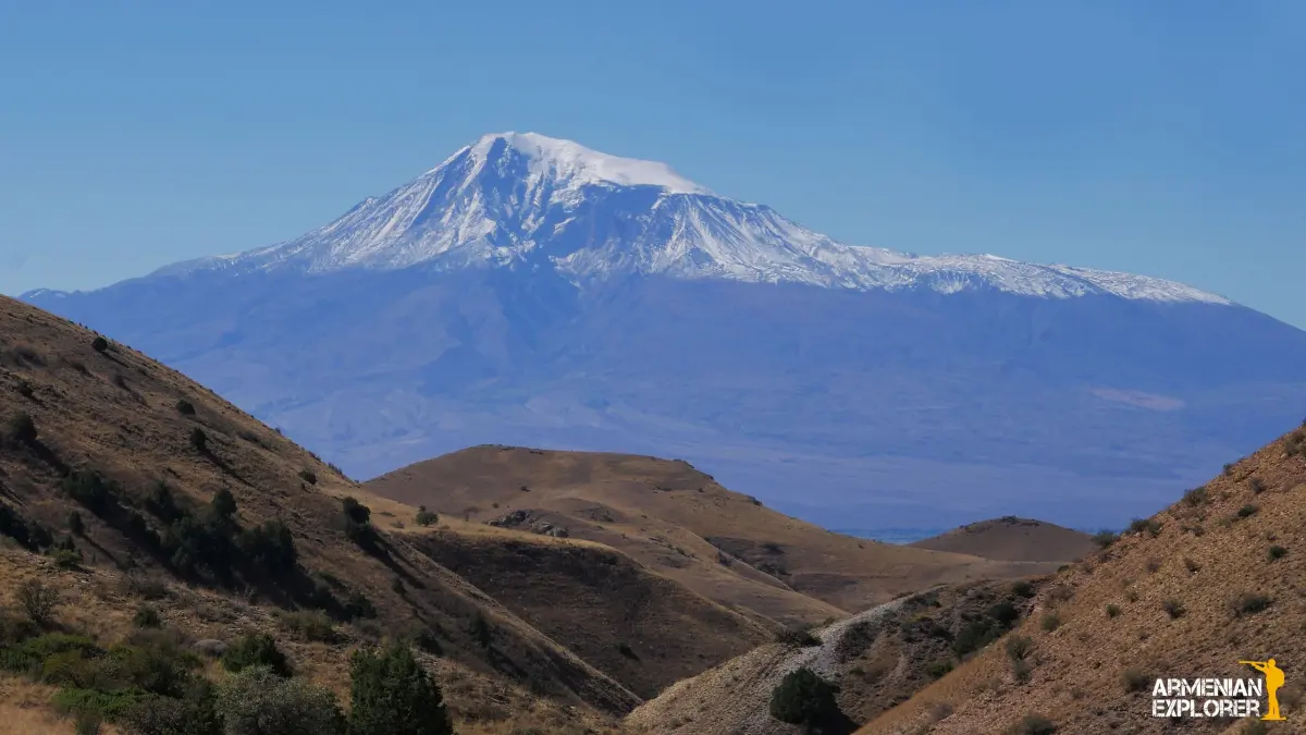
It is a common mistake to assume that a landform is a mountain simply because it is tall. A high plateau, for instance, might be thousands of feet above sea level, but because it is flat and expansive, it is not considered a mountain. True mountains are defined by their vertical relief—the difference in elevation between the base and the top. A peak that rises 3,000 feet from a valley floor is far more "mountainous" than a 5,000-foot peak that sits atop a high, elevated plain.
Furthermore, the geological age of a landform plays a significant role in its appearance. Younger mountain ranges, such as the Alps or the Rockies, are characterized by sharp, jagged peaks because erosion has not yet worn them down. Older mountain ranges, such as the Appalachians, have been subjected to millions of years of wind, water, and ice, resulting in more rounded, hill-like profiles. This process, known as denudation, can eventually transform a once-mighty mountain range into a series of rolling, low-lying hills over vast geological timescales.

Common mistakes when identifying landforms
When attempting to classify a landscape, observers often fall into traps based on colloquial naming. Many places around the world contain "Mount" or "Mountain" in their names despite being geologically classified as hills. Conversely, some significant peaks are locally referred to as hills to minimize their perceived danger or difficulty. To avoid these errors, rely on topographic maps rather than local nomenclature or visual estimation, which can be deceptive due to atmospheric perspective.
Follow these steps to accurately identify a landform:
- Consult a topographic map to determine the elevation gain from the base to the summit.
- Observe the surrounding terrain to see if the feature stands out as a distinct, high-relief entity.
- Check the regional geological survey records, which often provide the official classification for significant peaks.
- Assess the steepness; if the incline requires specialized climbing gear or creates a distinct timberline, it is likely a mountain.
- Compare the feature to known benchmarks in the area to determine if it fits the local definition of a mountain range.
Best tools for measuring landscape features
If you are interested in mapping or classifying terrain, modern technology provides precise tools that eliminate the guesswork of visual observation. Handheld GPS devices and smartphone applications now use barometric altimeters and satellite data to provide accurate elevation readings. These tools allow hikers and researchers to track their ascent and determine the exact vertical rise of a slope, helping them distinguish between a steep hill and a true mountain peak.
Digital Elevation Models (DEMs) are also invaluable for those studying geography from a distance. These datasets, compiled by satellite radar, provide a 3D representation of the Earth's surface. By analyzing this data, one can calculate the slope, aspect, and prominence of any landform on the planet. Whether you are a casual hiker or an aspiring geologist, using these resources will provide a much clearer understanding of the physical world than relying on casual observation alone. By understanding the interplay between geological history, vertical relief, and local climate, you can accurately identify the unique characteristics that define the diverse landscape features found across our planet.
Key facts
- A mountain is generally defined as a landform that rises significantly higher than its surroundings, typically exceeding 600 meters (2,000 feet) in elevation.
- Hills are smaller, rounded elevations of land that are usually less than 300 meters (1,000 feet) in height.
- The distinction between the two is often subjective, as many geographical organizations lack a universal, standardized height requirement.
- Mountains often feature steep, rugged slopes and distinct peaks, whereas hills are characterized by gentle, rolling terrain.
- Climatic conditions differ significantly; mountains often support distinct vegetation zones and snow caps, while hills typically share the climate of the surrounding plains.
- A common mistake is assuming that all high-elevation land is a mountain, when in fact, high-altitude plateaus can exist without being classified as mountains.
The bottom line
While height is a common indicator, the difference between a hill and a mountain lies primarily in slope, prominence, and ruggedness. Mountains are typically steep, high-altitude features that dominate the landscape, whereas hills are smaller, rounded landforms. Because these terms are often applied based on regional geography rather than strict scientific height thresholds, the most practical approach is to consider the landform's overall shape and local context.
People also ask
How do geologists officially classify a mountain?
Geologists often look for a combination of significant local relief, steep slopes, and a distinct summit area. While height is a factor, the prominence of the feature relative to the surrounding landscape is the primary technical metric.
Can a hill ever become a mountain?
Through geological processes like tectonic uplift or volcanic activity, a landform can increase in height over millions of years. If it eventually reaches a threshold of elevation and ruggedness defined by regional standards, it may be reclassified as a mountain.
Why are some mountains called hills?
Historical naming conventions often dictate terminology rather than strict scientific measurement. For instance, the Black Hills in South Dakota reach elevations of over 2,000 meters, yet they retain their colonial-era name despite meeting the technical criteria for mountains.
Do mountains and hills have different soil compositions?
Mountains often have thinner, rockier soil due to rapid erosion and steep gradients. Hills tend to have deeper, more stable soil layers that are frequently used for agriculture or grazing.
What is the difference between a mountain range and a hill country?
A mountain range is a series of connected mountains formed by the same tectonic process, such as the Himalayas. Hill country refers to a region characterized by a high density of small, rolling elevations rather than a singular, massive uplift.
Is there an international standard for these definitions?
There is no single international treaty or scientific body that sets a global height requirement. Definitions vary by country, with some nations using a 600-meter cutoff while others rely on topographical prominence or local cultural tradition.
This answer was created with the help of AI research tools and reference sources. Spotted an error? Let us know — we correct mistakes quickly. See our editorial policy.