What is the equator?
Short answer
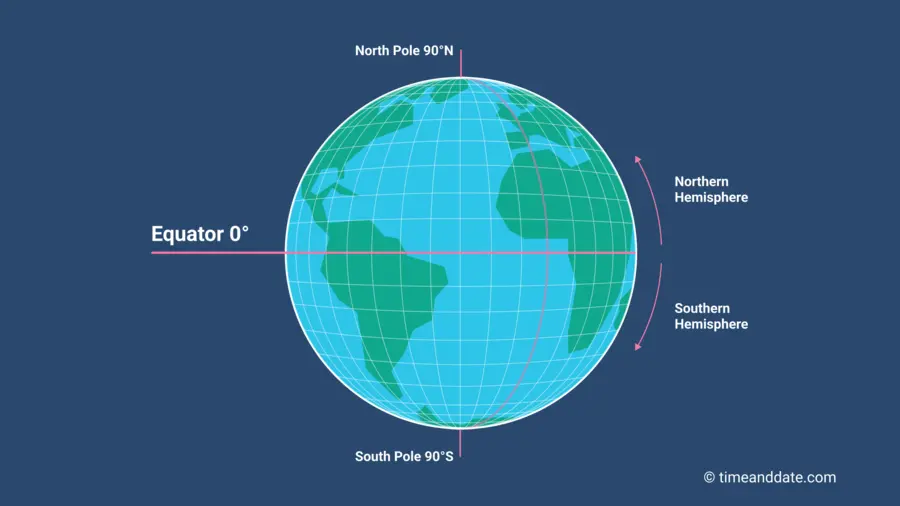
The equator is an imaginary line encircling the Earth, positioned exactly halfway between the North and South Poles. It divides the planet into the Northern and Southern Hemispheres. Measuring approximately 24,901 miles in circumference, this line serves as the zero-degree reference point for latitude, defining the global coordinate system used for navigation.
On this page
What is the equator exactly?
The equator is a fundamental geographic reference line that represents the plane perpendicular to the Earth’s axis of rotation. Because the Earth is an oblate spheroid—slightly flattened at the poles and bulging at the center—the equator marks the widest point of the planet. While it is invisible to the naked eye, it provides the essential baseline for measuring latitude, which ranges from 0 degrees at the equator to 90 degrees north or south at the poles.
Every point located on this line experiences unique solar conditions throughout the year. Because of its central position, the equator receives more direct sunlight than any other latitude. This geographic placement is the primary reason why regions near the equator maintain relatively consistent temperatures and day lengths regardless of the season. It acts as the anchor for the entire system of parallels that help mariners, pilots, and cartographers determine their precise location on the globe.
How does the equator affect climate?
The climate near the equator is defined by high temperatures and significant precipitation. Because the sun remains nearly overhead throughout the year, the atmosphere in this region absorbs a high concentration of solar energy. This heat causes rapid evaporation of moisture from oceans and dense rainforests, leading to the formation of frequent, heavy rain showers. These tropical conditions are consistent, often resulting in a lack of traditional seasonal changes like those found in temperate zones.
Several key factors influence the weather patterns observed along this imaginary line:
- The Intertropical Convergence Zone (ITCZ) creates a belt of low pressure where trade winds from both hemispheres meet.
- High humidity levels are maintained by the constant evaporation from the warm equatorial waters.
- Dense vegetation, such as the Amazon and Congo rainforests, thrives due to the year-round warmth and rainfall.
- Tropical cyclones are rare directly on the equator because the Coriolis effect, which is necessary to spin these storms, is virtually nonexistent at zero degrees latitude.
Why is the equator important for navigation?
For centuries, the equator has served as the primary reference point for global navigation. Sailors and pilots use it to calculate their position relative to the North and South Poles. By establishing the equator as zero degrees latitude, mapmakers created a standardized grid that allows for precise tracking of movement across the Earth's surface. Without this fixed reference, coordinating international travel and logistics would be significantly more complex and prone to error.
Modern navigation relies on this historical foundation, integrating it into satellite-based systems like GPS. When you track a flight or a ship, the coordinates provided are always measured in relation to this central line.
- Determine your current latitude using a sextant or GPS device.
- Compare your reading to the zero-degree baseline of the equator.
- Identify whether you are in the Northern or Southern Hemisphere based on your distance from the line.
- Adjust your navigational heading to account for the curvature of the Earth as you move toward or away from the equatorial plane.
Where does the equator pass through?
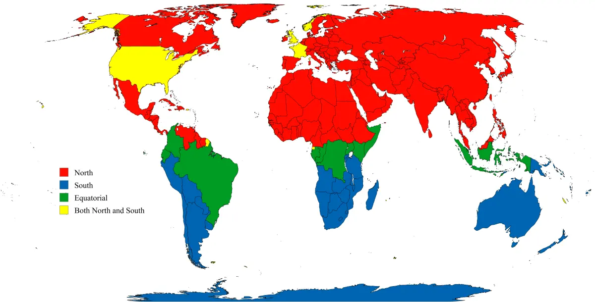
The equator crosses both land and water, spanning approximately 24,901 miles around the Earth's circumference. It passes through the territories of 13 sovereign nations, creating unique cultural and geographic intersections. These countries include Ecuador, Colombia, Brazil, Sao Tome and Principe, Gabon, Republic of the Congo, Democratic Republic of the Congo, Uganda, Kenya, Somalia, Maldives, Indonesia, and Kiribati.
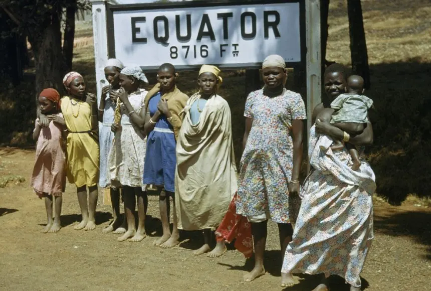
In many of these locations, local governments and tourism boards have installed monuments to mark the exact path of the line. Visitors often travel to these sites to stand with one foot in the Northern Hemisphere and the other in the Southern Hemisphere. While the line itself is not physically marked on the ground, the monuments provide a tangible way to understand the scale of the planet. Traveling across these diverse regions reveals how the equatorial climate shapes everything from local agriculture and architecture to the daily routines of the people living directly on the line.
Common mistakes when studying the equator
A frequent misconception is that the equator is a physical boundary that causes sudden, dramatic changes in the environment or gravity. In reality, the transition across the equator is gradual, and the "bulge" of the Earth is not something a person can feel while standing on the line. Another common error is assuming that the equator experiences summer and winter. Because the sun’s angle remains high throughout the year, these regions do not experience the extreme seasonal temperature shifts found in higher latitudes.
To avoid confusion when studying or traveling to equatorial regions, keep these practical points in mind:
- Do not assume the weather is identical everywhere on the equator; altitude plays a massive role in temperature, meaning mountain peaks on the line can be freezing.
- Avoid the mistake of thinking gravity is significantly weaker at the equator; while the centrifugal force of the Earth's rotation does reduce gravity slightly, it is not enough to be detected by human senses.
- Remember that the equator is a geographic coordinate, not a political one, meaning it does not dictate the laws or borders of the countries it crosses.
- Always check local weather forecasts, as microclimates can create significant variations in rainfall even within a few miles of the equatorial path.
Key facts
- The equator is an imaginary line encircling the Earth at 0 degrees latitude, dividing it into the Northern and Southern Hemispheres.
- It spans approximately 24,901 miles (40,075 kilometers) in circumference.
- Countries located directly on the equator experience roughly 12 hours of daylight and 12 hours of darkness throughout the year.
- The equator passes through 13 countries, including Ecuador, Brazil, Kenya, Indonesia, and Gabon.
- Because the Earth bulges at the center due to rotation, the equator is the point on the planet furthest from its axis.
- Travelers visiting the equator often mistake the Coriolis effect for a simple sink-drain phenomenon, though it does not actually influence water rotation in household basins.
The bottom line
The equator is the fundamental reference point for global geography, defining the boundary between the Northern and Southern Hemispheres. By understanding this 0-degree latitude line, you gain a better grasp of how Earth’s climate, gravity, and navigation systems function. Whether you are studying global weather patterns or planning a trip to the tropics, recognizing the equator's role helps you orient yourself accurately on our planet.
People also ask
Does the equator have a specific climate?
The equator is generally characterized by a tropical climate with high temperatures and significant rainfall year-round. Because it receives the most direct sunlight, seasonal variations are minimal compared to higher latitudes.
How do you identify the exact location of the equator?
You can identify the equator using a GPS device or by visiting a marked monument, such as the Mitad del Mundo in Ecuador. Note that some older monuments were placed slightly off-center due to historical surveying limitations.
Is it true that you weigh less at the equator?
Yes, you weigh slightly less at the equator than at the poles due to the Earth's centrifugal force and its equatorial bulge. This effect is measurable with precision instruments but is not noticeable to the human body.
Do ships and planes need to adjust for the equator?
Navigationally, the equator serves as the primary reference point for latitude, but it does not require physical adjustments for travel. Pilots and captains use it to calibrate their instruments and calculate distances across the globe.
What is the significance of the equator in astronomy?
The celestial equator is an projection of the Earth's equator into space. It serves as the 0-degree line for the celestial coordinate system used by astronomers to map the stars.
Can you see the equator from space?
No, the equator is an entirely imaginary line and cannot be seen from space. Features like coastlines or mountain ranges are visible, but there is no physical mark separating the two hemispheres.
This answer was created with the help of AI research tools and reference sources. Spotted an error? Let us know — we correct mistakes quickly. See our editorial policy.