What is the difference between a sea and an ocean?
Short answer
Oceans are vast, interconnected bodies of saltwater that cover the majority of Earth’s surface, while seas are smaller, partially enclosed segments of the ocean often located near landmasses. Although the terms are sometimes used interchangeably in casual conversation, oceanographers distinguish them based on their size, depth, and geological relationship to continents.
On this page
What defines an ocean
The Earth features five primary ocean basins: the Pacific, Atlantic, Indian, Southern, and Arctic. These massive bodies of water are defined by their immense scale, covering approximately 71 percent of the planet's surface. They are characterized by deep basins, complex circulation patterns, and a direct connection to the global oceanic conveyor belt that regulates climate.
Geologically, oceans sit upon oceanic crust, which is thinner and denser than the continental crust found beneath landmasses. Because they are so vast, they contain the majority of the planet's water and support diverse ecosystems that remain largely unexplored by humans. Understanding the distinction begins with recognizing that oceans are the primary, foundational reservoirs of the world's saltwater system.
How to distinguish a sea from an ocean
Seas are typically smaller than oceans and are partially or fully enclosed by land. While they are still composed of saltwater and are connected to the global ocean system, their physical boundaries are defined by continental coastlines or chains of islands. For instance, the Mediterranean Sea is almost entirely surrounded by Europe, Africa, and Asia.
There are three primary categories used to classify these bodies of water:
- Marginal seas: Located at the edges of oceans, such as the North Sea or the Bering Sea.
- Enclosed seas: Landlocked or nearly landlocked bodies, like the Black Sea or the Caspian Sea.
- Mediterranean seas: Large basins that connect to the ocean through narrow straits, such as the Mediterranean Sea itself.
These classifications help scientists study specific environmental conditions, such as salinity levels and temperature fluctuations, which often differ significantly from the open ocean due to the proximity of land and freshwater runoff from rivers.
Why salinity and depth vary between them
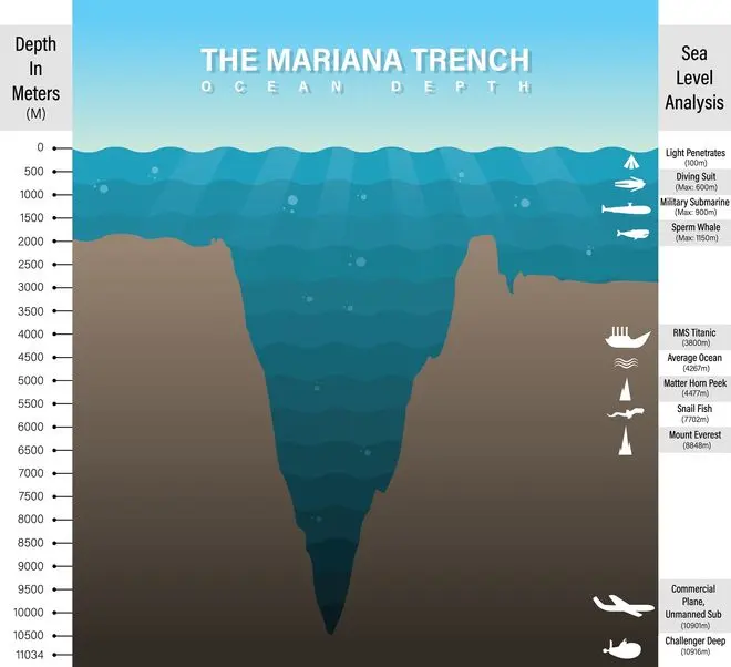
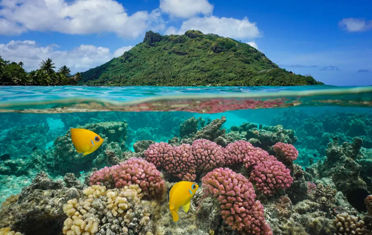
Depth is one of the most practical ways to differentiate between these two features. Oceans possess vast, deep abyssal plains that can reach depths of over 36,000 feet, such as the Mariana Trench in the Pacific. In contrast, seas are generally much shallower, often sitting on continental shelves that allow sunlight to penetrate to the seafloor, fostering vibrant coral reefs and dense marine life.
Salinity levels also differ due to the interaction with land. Seas that are enclosed or located in arid regions, such as the Red Sea, often have higher salinity because of high evaporation rates and limited freshwater inflow. Conversely, seas located near major river deltas may have lower salinity levels than the open ocean. These chemical variations create unique habitats that are distinct from the relatively stable, uniform conditions found in the deep, open waters of the major ocean basins.
Common mistakes when classifying water bodies
A frequent error is assuming that all bodies of water labeled as "seas" are connected to the ocean. The Caspian Sea is a notable exception; despite its name, it is technically the world's largest inland lake because it is completely landlocked and has no natural outlet to the global ocean. Similarly, the Sea of Galilee is a freshwater lake, showing that the term "sea" is sometimes applied based on historical or cultural naming conventions rather than strict scientific definitions.
To avoid confusion, consider these factors when identifying a body of water:
- Check for an outlet: Does the water connect to a larger ocean basin?
- Examine the crust: Is it sitting on oceanic or continental crust?
- Review the size: Is it a massive basin or a regional feature?
Relying solely on the name is often misleading, as geography and history play a larger role in how these names were assigned centuries ago.
Best ways to study marine geography
For those interested in exploring these differences, the best approach is to utilize bathymetric maps. These maps visualize the depth and topography of the seafloor, clearly showing where the continental shelf drops off into the deep ocean basin. By comparing the depth profiles of the Caribbean Sea against the Atlantic Ocean, you can immediately see the physical constraints that define the former as a sea.
If you are just beginning your study of marine science, start by focusing on the major ocean basins. Once you understand the global circulation patterns of the Pacific and Atlantic, it becomes much easier to see how smaller seas function as regional extensions. You can use satellite imagery to observe the flow of currents, which often demonstrates how water moves from the open ocean into these smaller, more contained basins. By keeping these physical and geological differences in mind, you will gain a much clearer understanding of how the world's water is organized across the globe.
Key facts
- Oceans cover approximately 71 percent of the Earth's surface and contain about 97 percent of all water on the planet.
- Seas are generally smaller and shallower than oceans and are often partially enclosed by landmasses.
- There are five recognized oceans: the Pacific, Atlantic, Indian, Southern, and Arctic.
- The Sargasso Sea is unique because it is defined by ocean currents rather than land boundaries.
- When navigating, remember that seas often have higher salinity levels due to increased evaporation in enclosed areas.
- Do not confuse a sea with a lake; even if a body of water is called a sea, such as the Caspian Sea, it may be a landlocked lake.
The bottom line
While the terms are often used interchangeably in casual conversation, the distinction lies in size, depth, and land boundaries. Oceans are the massive, deep basins that define the global water cycle, while seas are smaller, shallower regions often bordered by land. Understanding this geographical classification helps clarify how currents, ecosystems, and climate patterns function across the planet's vast, interconnected marine environments.
People also ask
Why is the Caspian Sea considered a lake?
The Caspian Sea is technically a lake because it is completely surrounded by land and has no natural outlet to the world ocean. Despite its massive size and saline water, it does not meet the geological definition of a sea.
How many oceans are there globally?
Scientists officially recognize five oceans: the Pacific, Atlantic, Indian, Southern, and Arctic. These basins are interconnected, forming a single global ocean system.
Are all seas connected to the ocean?
Most seas are connected to the ocean via narrow straits or channels. However, some inland seas are isolated from the global ocean system.
What is the deepest part of the ocean?
The Challenger Deep in the Mariana Trench is the deepest known point in the ocean, reaching approximately 10,935 meters below sea level. Seas are significantly shallower, rarely exceeding a few thousand meters.
Read the full answer →Can a sea be part of an ocean?
Yes, many seas are geographically considered subdivisions of an ocean. For example, the Mediterranean Sea is a large body of water that connects to the Atlantic Ocean.
Does the water temperature differ between seas and oceans?
Seas often experience more extreme temperature fluctuations than the open ocean. Because they are shallower and partially enclosed, they are more susceptible to seasonal heating and cooling from the surrounding land.
This answer was created with the help of AI research tools and reference sources. Spotted an error? Let us know — we correct mistakes quickly. See our editorial policy.