How do clouds form?
Short answer
Clouds form when invisible water vapor in the air cools and condenses into liquid water droplets or ice crystals. This process occurs as air rises, expands, and chills, eventually reaching its dew point. These droplets then cluster around microscopic particles, such as dust or salt, suspended in the atmosphere to become visible.
On this page
Why clouds form in the atmosphere
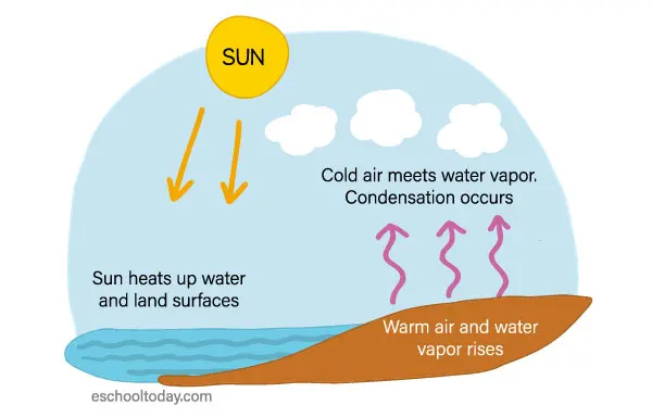
The fundamental driver of cloud formation is the cooling of air. As the sun heats the Earth's surface, pockets of warm air become less dense and begin to rise through the atmosphere. Because atmospheric pressure decreases with altitude, this rising air expands. According to the laws of thermodynamics, as a gas expands, its temperature drops. Once the air cools to its dew point—the temperature at which it can no longer hold all of its water vapor—the vapor begins to transition into liquid form.
However, water vapor requires a surface to transition into a liquid state. In the sky, this surface is provided by cloud condensation nuclei (CCN). These are microscopic particles such as dust, pollen, smoke, sea salt, or industrial pollutants. Without these tiny particles, the air would need to be significantly supersaturated for droplets to form spontaneously. Once the vapor clings to these particles, billions of these droplets cluster together to create the visible white or gray masses we recognize as clouds.
How air rises to create clouds
Air does not rise on its own; it requires a physical mechanism to push it upward. Meteorologists identify four primary ways that air is lifted into the atmosphere to trigger cloud development:
- Convection: Sun-warmed ground heats the air above it, causing buoyant bubbles of air to rise.
- Orographic lift: Air is forced upward when it encounters a mountain range or high terrain.
- Convergence: Winds from different directions collide, forcing the air at the center to move upward.
- Frontal lifting: A wedge of cold, dense air pushes under a mass of warmer, lighter air, forcing it to rise.
These mechanisms determine the type of cloud that appears. For example, convection often leads to puffy, vertical cumulus clouds, while frontal lifting typically creates broad, layered stratus clouds. Understanding these lifting mechanisms is essential for predicting weather patterns and identifying when a clear sky might soon become overcast or stormy.

What types of clouds exist
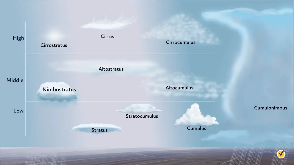
Clouds are categorized primarily by their altitude and their physical appearance. The World Meteorological Organization classifies them into ten main genera based on these traits. High-level clouds, such as cirrus, form above 20,000 feet and are composed almost entirely of ice crystals. Mid-level clouds, designated with the prefix "alto-," appear between 6,500 and 20,000 feet. Low-level clouds, such as stratus or cumulus, generally exist below 6,500 feet.
- Cirrus: Thin, wispy, hair-like clouds made of ice.
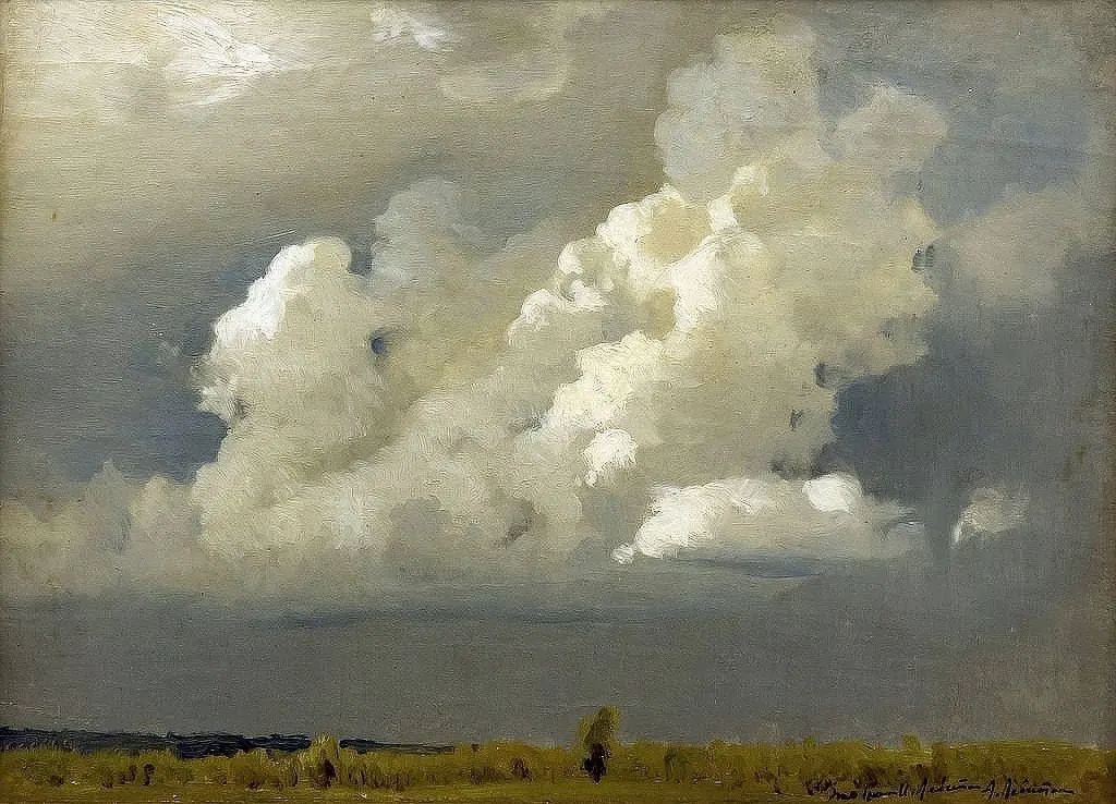
- Cumulus: Fluffy, cotton-like clouds with flat bases.
- Stratus: Featureless, gray sheets that often cover the entire sky.
- Nimbus: A suffix or prefix indicating that the cloud is producing precipitation.
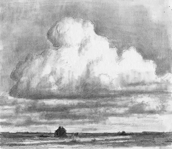
- Cumulonimbus: Towering, dense clouds associated with thunderstorms and heavy rain.
By observing these shapes, you can often determine the stability of the atmosphere. Flat, layered clouds suggest stable air, while vertical, towering clouds indicate instability and potential convective activity.
Common mistakes when identifying clouds
A frequent error is assuming that all white clouds are fair-weather clouds. While smaller cumulus clouds often indicate a pleasant day, their vertical growth can signal a transition into a cumulonimbus storm cloud. Another mistake is ignoring the speed at which clouds move or change shape. Rapid changes in cloud structure usually indicate strong winds or significant temperature shifts in the upper atmosphere, which are precursors to changing weather conditions.
Additionally, many people confuse fog with clouds. Fog is technically a cloud that is in contact with the ground. It forms through the same cooling processes, such as radiation cooling at night or warm air moving over a cold surface. Treating fog as a separate phenomenon rather than a low-altitude cloud can lead to misunderstandings about how humidity and temperature interact. Always look at the base of the cloud to gauge its height and assess the surrounding moisture levels to better predict if the cloud will dissipate or grow.
How to observe clouds like a meteorologist
To track cloud development, start by observing the sky during the early morning. Note the initial presence of small, scattered clouds and watch how they evolve over several hours. If they grow vertically, you are likely witnessing the effects of daytime solar heating. Use a simple notebook or a weather app to record the cloud types you see throughout the day. This practice helps you correlate specific cloud formations with the weather that follows, such as rain, wind, or clearing skies.
When observing, pay close attention to the base of the cloud. A dark, ragged base often indicates high water content and potential precipitation. Conversely, a bright, crisp edge usually suggests a cloud is still in its growth phase or is thinning out. By consistently practicing these observations, you will develop a better intuition for atmospheric physics. Remember that the sky is a dynamic, three-dimensional environment, and even the smallest shifts in wind direction or humidity can significantly alter the lifecycle of a cloud.
Key facts
- Clouds form when invisible water vapor in the air cools and condenses into tiny liquid water droplets or ice crystals.
- Air must reach its "dew point," the temperature at which it becomes saturated and can no longer hold all its water vapor as a gas.
- Condensation requires "cloud condensation nuclei," which are microscopic particles like dust, salt, or smoke that provide a surface for water to cling to.
- Rising air is the primary driver of cloud formation, occurring through surface heating, mountain slopes, or weather fronts pushing air upward.
- As air rises, it expands and cools because the atmospheric pressure decreases at higher altitudes.
- Clouds are categorized by their altitude, ranging from low-level stratus clouds below 6,500 feet to high-level cirrus clouds above 20,000 feet.
The bottom line
Cloud formation is a fundamental atmospheric process driven by the cooling of rising air. When water vapor reaches its dew point, it condenses onto microscopic particles to form the visible droplets we recognize as clouds. Understanding this cycle explains everything from daily weather patterns to the global water distribution. By observing cloud shapes and heights, you can effectively predict incoming weather changes in your local area.
People also ask
Why are clouds white?
Clouds appear white because the water droplets or ice crystals within them are large enough to scatter all wavelengths of visible sunlight equally. This process, known as Mie scattering, combines all colors of the spectrum to produce white light.
Why do some clouds look dark or gray?
Clouds look dark when they become thick or dense enough to block out the sunlight from reaching the observer below. The bottom of a cloud often appears gray because it is in the shadow of the upper layers of the cloud.
Can clouds form without dust or particles in the air?
Technically, water vapor can condense into pure droplets in extremely clean air, but this requires massive supersaturation levels rarely found in nature. In the real world, aerosols like sea salt and soot are essential to initiate cloud formation at normal humidity levels.
What is the difference between fog and a cloud?
There is no physical difference between fog and a cloud; they are both composed of the same water droplets. The distinction is purely based on location, as fog is defined as a cloud that is in contact with the ground.
How do clouds stay afloat in the air?
Clouds stay aloft because the individual water droplets are incredibly small and light, allowing them to be kept suspended by even the weakest upward air currents. These droplets are so light that they fall at an extremely slow rate, which is often countered by rising air.
Do clouds contain pure water?
Clouds contain water that is generally quite pure, but it is not distilled. As the water vapor condenses around particles, it incorporates trace amounts of the chemical substances found in those aerosols, such as sulfates or sea salts.
This answer was created with the help of AI research tools and reference sources. Spotted an error? Let us know — we correct mistakes quickly. See our editorial policy.