How can I draw a world map easily?
Short answer
Drawing a world map is best achieved by using a simple grid or geometric framework to maintain accurate proportions. By sketching a central equator line and dividing the globe into manageable rectangles, you can plot major continents step-by-step. Focus on relative shapes rather than precise cartographic detail to ensure a recognizable result.
On this page
How to draw a world map using a grid
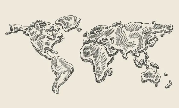
The most efficient way to draw a world map is to utilize a basic grid system, which helps maintain the spatial relationship between continents. Start by drawing a horizontal line across the center of your paper to represent the equator. Then, draw two more horizontal lines above and below it to mark the Tropics of Cancer and Capricorn. This framework prevents the common error of making one hemisphere significantly larger than the other.
Once your horizontal lines are set, draw vertical lines to divide the paper into columns. These columns act as guides for placing the continents. For example, the Americas generally occupy the left-hand columns, while Europe, Africa, and Asia fill the center and right. By focusing on these specific zones, you avoid the frustration of running out of space on one side of the page.
- Draw a long horizontal line for the equator.
- Add two lines above and below for the tropics.
- Divide the paper into six vertical columns.
- Sketch the outlines of continents within these boxes.
Best tools for beginners
You do not need professional drafting equipment to create a functional map. A standard HB pencil is ideal for initial sketches because it allows you to erase mistakes easily without damaging the paper. A soft eraser is essential, as you will likely need to adjust the curves of coastlines multiple times during the process. Using a ruler for your initial grid lines ensures that your underlying structure remains perfectly straight and consistent.
When you are ready to finalize your map, fine-tipped pens or markers are excellent for tracing your pencil lines. Colored pencils are also useful for distinguishing between landmasses and oceans. If you are a beginner, it is helpful to have a reference map nearby to compare your proportions. Avoid using heavy ink too early, as it makes correcting the inevitable slip of the hand nearly impossible.
- HB pencil for light sketching.
- Plastic eraser for clean corrections.
- Ruler for establishing the grid.
- Fine-tipped pens for final outlines.
- Colored pencils for shading water and land.
Why map distortion happens
Every flat map of the Earth suffers from distortion because it is impossible to represent a three-dimensional sphere on a two-dimensional surface without stretching or tearing. This is known as the map projection problem. When you draw a map by hand, you are essentially creating a custom projection. You will notice that landmasses near the top and bottom of your paper often appear elongated or squashed compared to those near the equator.
This effect is most famously observed in the Mercator projection, which makes Greenland appear as large as Africa, even though Africa is actually 14 times larger. When drawing your own map, do not worry about perfect mathematical accuracy. Focus instead on the recognizable silhouettes of the continents. Understanding that distortion is an inherent part of cartography will help you feel less discouraged when your drawing does not perfectly match a satellite image.
Common mistakes when drawing maps
One of the most frequent errors is neglecting the size of the oceans, which often leads to continents appearing too close together. Beginners often draw the landmasses first and then try to squeeze the water in, which results in a cramped, inaccurate appearance. Always sketch the rough shapes of the oceans first to ensure there is enough space for the continents to sit correctly. This approach provides a much more balanced final composition.
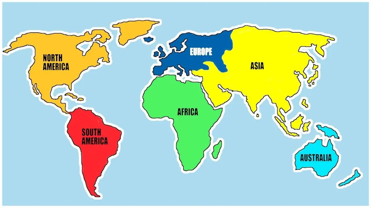
Another common mistake is attempting to include too much detail, such as small islands, fjords, or jagged coastlines. At a small scale, these features become cluttered and difficult to read. Simplify the shapes of the continents into basic geometric forms first. Once the overall layout looks correct, you can add minor details to the coastlines. Remember that a map is a tool for communication, not a high-resolution photograph of the planet.
- Drawing continents too large, leaving no room for oceans.
- Ignoring the curvature of the Earth near the poles.
- Adding excessive detail before establishing the main shapes.
- Failing to use a grid, leading to lopsided proportions.
How to improve your map drawing skills
Practice is the most important factor in improving your cartographic abilities. Start by copying simple maps from an atlas to understand how different countries relate to one another. Over time, you will develop a "mental map" that allows you to draw continents from memory with greater speed and accuracy. Try drawing the map from different perspectives, such as centering it on the Pacific Ocean rather than the Atlantic, to broaden your understanding of global geography.
If you find that your proportions are consistently off, try using a light box or a window to trace a basic outline of a map first. This helps your hand learn the muscle memory required for drawing specific shapes like the boot of Italy or the curve of the Arabian Peninsula. As you gain confidence, gradually remove the reference material and rely on your grid system. With consistent effort, you will be able to sketch a recognizable world map in just a few minutes.
Key facts
- Use a grid system to maintain correct proportions between continents.
- Draw the equator as a horizontal center line to establish a vertical reference point.
- Start with the largest landmasses, such as Eurasia and Africa, to anchor the map.
- Use simple geometric shapes like triangles or ovals to represent the rough outlines of land.
- Keep the Mercator projection in mind, where landmasses near the poles appear larger than they are.
- Practice drawing the "S" curve of the Atlantic Ocean to help space the Americas from Europe and Africa.
The bottom line
Drawing a world map is best approached as a structural exercise rather than a freehand sketch. By utilizing a grid and focusing on major continental shapes first, you can maintain accurate proportions across the page. Remember that all flat maps involve some degree of distortion, so focus on capturing the general relationships between landmasses rather than achieving perfect precision in every small coastline detail.
People also ask
What is the easiest map projection to draw by hand?
The Robinson projection is often preferred for sketching because it offers a visually balanced compromise between shape and area. It avoids the extreme distortion found in the Mercator projection while remaining easier to construct than complex equal-area maps.
Why do maps often look different from each other?
Maps are two-dimensional representations of a three-dimensional sphere, which necessitates distortion. Cartographers choose different projections depending on whether they need to preserve accurate angles, distances, or landmass sizes.
Should I use a reference image while drawing?
Yes, using a reference image is essential for maintaining geographical accuracy. Even professional cartographers use base maps to ensure that coastlines and islands are placed in their correct relative positions.
How do I handle small islands and archipelagos?
Focus on the major continental outlines first and add smaller islands only after the main landmasses are correctly proportioned. If the map is small, it is often better to omit minor islands to avoid cluttering the drawing.
Is it better to draw with a pencil or a pen?
Always start with a light graphite pencil to allow for corrections. Once the proportions are accurate and the coastlines are refined, you can trace over the lines with a permanent pen.
What is the most common mistake when drawing a world map?
The most frequent error is failing to account for the curvature of the Earth, leading to landmasses that look flat or incorrectly spaced. Beginners often draw the Atlantic Ocean too narrow or forget the relative size of Greenland.
This answer was created with the help of AI research tools and reference sources. Spotted an error? Let us know — we correct mistakes quickly. See our editorial policy.