What is the difference between a bay and a gulf?
Short answer
Bays and gulfs are both coastal indentations where the ocean extends into the land, but they differ primarily in size and shape. Generally, a gulf is a large, deep inlet with a narrow opening, while a bay is a smaller, shallower body of water with a wider mouth and calmer currents.
On this page
What is the geographical difference between a bay and a gulf?
Geographically, the terms are often used interchangeably in common parlance, but oceanographers distinguish them based on scale and geometry. A gulf is typically a significant, large-scale indentation of the coastline, often formed by plate tectonics or massive geological shifts. These bodies of water are usually deeper and more enclosed by land than bays, creating a distinct separation from the open ocean.
In contrast, a bay is generally smaller and serves as an indentation along a larger body of water, such as a sea or an ocean. Because they are smaller, bays are more influenced by the immediate coastal environment. They often provide a sheltered harbor where the water is significantly calmer than in the open sea. While there is no rigid scientific rule defining the exact square mileage that separates one from the other, the following characteristics typically apply:
- Gulfs: Often span hundreds of miles, possess deep water, and have narrow entrances.
- Bays: Usually cover smaller areas, have shallower depths, and feature wide, open mouths.
How are these coastal features formed?
The formation of these inlets is primarily driven by the movement of tectonic plates and the erosive power of water over millions of years. Gulfs are frequently created by large-scale tectonic activity, such as the rifting of continents or the sinking of massive landmasses. For example, the Gulf of Mexico was formed through complex geological processes involving the shifting of the North American Plate and the gradual subsidence of the seafloor.
Bays are more commonly the result of coastal erosion and sea-level fluctuations. As waves strike the coastline, they erode softer rock more quickly than harder rock, carving out curved inlets. When sea levels rise, these eroded areas fill with water, creating the characteristic shape of a bay. Over time, sediment deposition can further alter the shape of these inlets, sometimes turning a bay into a lagoon or a marshland.
- Tectonic rifting creates deep, massive gulfs.
- Wave erosion carves out smaller, curved bays.
- Sea-level rise floods coastal depressions to form both features.
Why are bays and gulfs important for navigation and trade?
Throughout history, these coastal indentations have served as the lifeblood of maritime commerce. Because they offer protection from the intense winds and high waves of the open ocean, they provide ideal locations for natural harbors. Ships can anchor safely in these waters, facilitating the loading and unloading of cargo. Major global cities, such as New York, which sits on the New York Bay, grew into economic powerhouses largely due to the sheltered access provided by their geography.
Beyond trade, these areas are critical for naval strategy and resource extraction. Gulfs, due to their size, often contain vast offshore oil and gas reserves. The Persian Gulf, for instance, is one of the most vital regions in the world for energy transport. Navigating these waters requires a deep understanding of local tides and currents, as the narrow openings of gulfs can create powerful tidal surges that pose challenges to even the most experienced mariners.
Common mistakes when identifying coastal features
A frequent error is assuming that the name of a body of water is a perfect indicator of its geological classification. Cartographers and explorers historically named these features based on local observations rather than strict scientific criteria. Consequently, some bodies of water labeled as "bays" are actually quite large, while some "gulfs" are relatively small. For example, the Bay of Bengal is significantly larger than many bodies of water classified as gulfs, illustrating that naming conventions are often historical rather than scientific.
Another mistake is ignoring the role of human influence on these landscapes. Humans have frequently modified these natural inlets through dredging, the construction of breakwaters, and the building of artificial ports. These interventions can change the water depth, current patterns, and even the shape of the shoreline, making it difficult to distinguish the original geological formation from the human-modified structure. When studying these areas, it is essential to look at geological maps rather than relying solely on the name printed on a map.
- Do not rely on the name alone; check the bathymetry.
- Consider the historical context of the naming.
- Differentiate between natural formation and human-made modifications.
How to observe these features in the wild
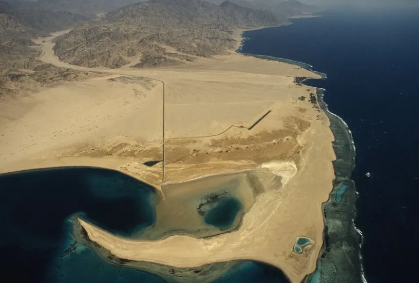
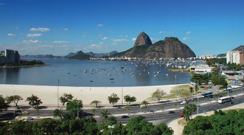
If you are visiting a coastal region, you can identify these features by observing the relationship between the land and the water. To determine if you are looking at a bay, look for a wide, sweeping curvature where the land recedes significantly, creating a sheltered area that is clearly connected to a larger sea. You will often notice that the water inside a bay is much calmer than the water just outside the entrance, as the headlands act as a barrier to incoming swells.
When observing a gulf, look for a much larger scale. If you are standing on the shore, you may not be able to see the opposite side of the water, and the entrance to the ocean might be restricted by peninsulas or islands. Understanding these features helps in appreciating the complex geography of our planet. By paying attention to the shape of the coastline and the behavior of the tides, you can better understand how these natural formations shape the environment, influence local weather patterns, and provide essential habitats for marine life.
Key facts
- A gulf is typically larger and more deeply indented into the coastline than a bay.
- Bays often serve as sheltered harbors for ships, while gulfs are frequently significant regional seas.
- Geographers do not always apply strict size thresholds, meaning names are often determined by historical tradition.
- The Gulf of Mexico covers approximately 600,000 square miles, dwarfing most named bays.
- Hudson Bay is an exception to the size rule, as it is massive despite being labeled a bay.
- When identifying these features on a map, look for the degree of enclosure by land to distinguish between the two.
The bottom line
While the terms are often used interchangeably in casual conversation, the primary distinction lies in scale and enclosure. Gulfs are generally vast, deep, and deeply indented features of the coastline, whereas bays are typically smaller, more sheltered, and provide natural harbor conditions. However, because historical naming conventions often override strict geological definitions, you should always consult a nautical chart when precise geographic classification is required.
People also ask
Is a sound the same thing as a bay?
A sound is generally a long, wide inlet of the ocean that is larger than a bay and often connects two larger bodies of water. Unlike many bays, sounds are usually formed by submerged river valleys or glacial erosion.
Why are some bodies of water called bights?
A bight is a curve or recess in a coastline that is shallower and more open than a bay or gulf. They lack the significant land enclosure that defines the other two features.
Can a bay be located inside a gulf?
Yes, it is common for smaller bays to be nested within the larger geographic footprint of a gulf. For example, Galveston Bay is located along the coast of the Gulf of Mexico.
How are fjords different from bays?
A fjord is a specific type of narrow, deep inlet created by glacial activity, characterized by steep cliffs on either side. While they function similarly to bays, their geological origin is distinct.
Does the depth of the water matter for classification?
While depth is not the primary factor, gulfs are often deeper than bays due to their larger size and connection to open ocean currents. Bays are typically shallower, making them more suitable for docking and coastal navigation.
Are there legal differences between bays and gulfs?
Under international maritime law, the definition of a "legal bay" depends on the distance between its headlands. This determines how much of the water is considered internal territory of a nation.
This answer was created with the help of AI research tools and reference sources. Spotted an error? Let us know — we correct mistakes quickly. See our editorial policy.