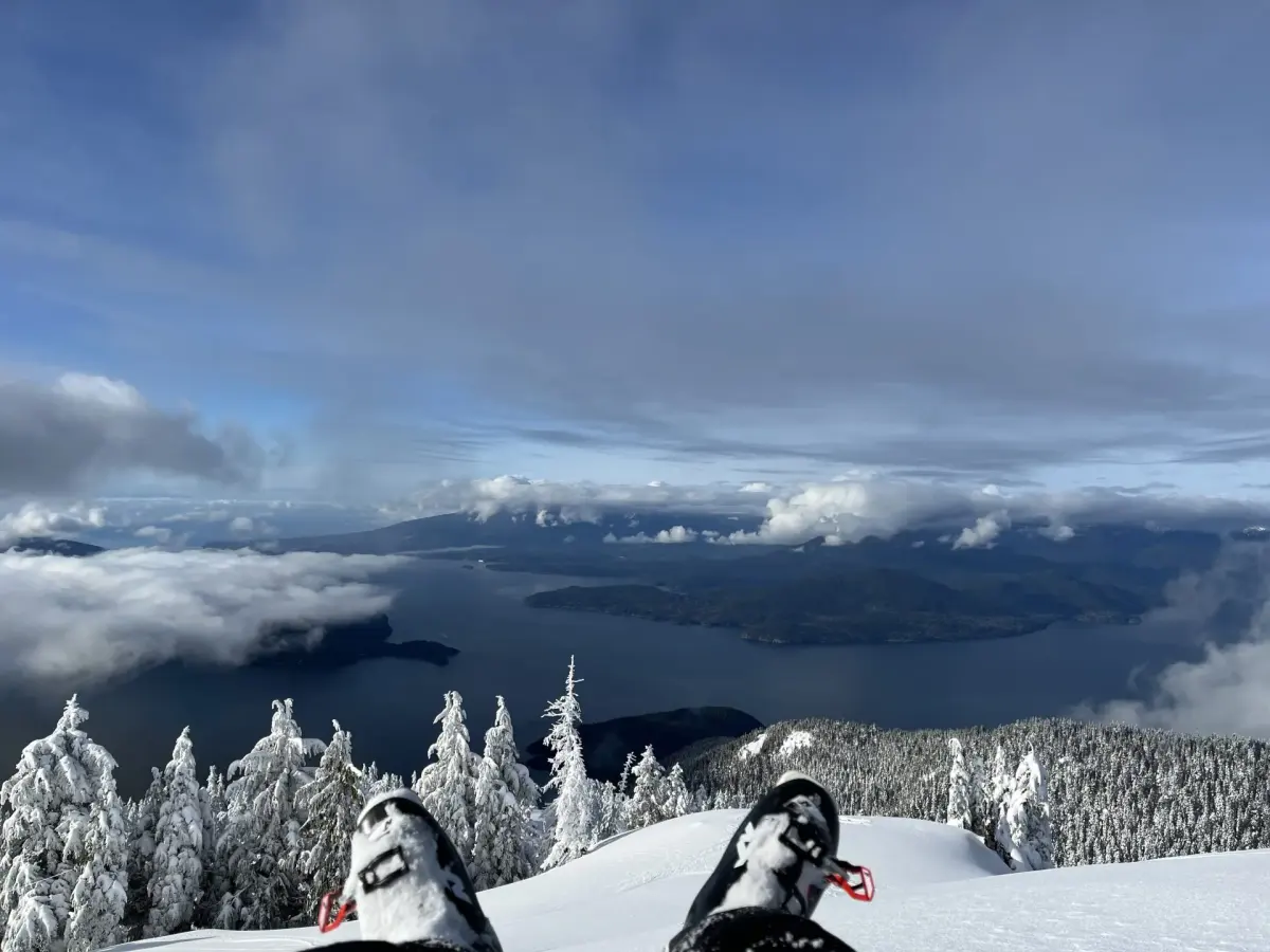
What is the Baden-Powell Trail?
Short answer
The Baden-Powell Trail is a 48-kilometer hiking route spanning the North Shore Mountains of British Columbia, Canada. Named after Lord Baden-Powell, the founder of the Scouting movement, the trail stretches from Horseshoe Bay in West Vancouver to Deep Cove in North Vancouver, offering diverse terrain, challenging elevation gains, and scenic coastal views.
On this page
How long does it take to hike the Baden-Powell Trail?
The full 48-kilometer trek is a significant undertaking that typically requires between 12 and 16 hours of active hiking time. Most experienced hikers choose to complete the route over two or three days to better manage the physical exertion and enjoy the surroundings. If you attempt the entire trail in a single push, you must start at dawn to ensure you finish before nightfall, as navigating the technical sections in the dark is hazardous.
For those looking to break the journey into manageable segments, the trail is officially divided into several distinct sections. Each segment offers different levels of difficulty and varying access points to local transit, making it highly customizable for day hikers. Whether you are aiming for a multi-day thru-hike or a series of shorter weekend excursions, consider these factors when planning your timeline:
- Physical fitness levels and previous experience with steep mountain terrain.
- Seasonal daylight hours, which vary significantly between summer and winter months.
- The weight of your pack, especially if you are carrying overnight camping gear.
- Weather conditions, which can rapidly deteriorate in the North Shore mountains.
Where is the Baden-Powell Trail located?
The trail traverses the rugged landscape of the North Shore Mountains, positioned directly across the Burrard Inlet from downtown Vancouver. It serves as a connector between the various parks and municipal areas of West Vancouver, the District of North Vancouver, and the City of North Vancouver. Because the trail crosses several major roads and residential neighborhoods, it is remarkably accessible compared to more remote wilderness routes.
The western terminus is situated at Horseshoe Bay, a major ferry terminal, while the eastern end concludes at the popular waterfront village of Deep Cove. Along the way, the path winds through dense temperate rainforests, crosses several mountain streams, and passes near prominent landmarks such as Cypress Mountain, Grouse Mountain, and Mount Fromme. Because of its location, the trail is subject to the maritime climate of the Pacific Northwest, meaning hikers should be prepared for frequent rain, mist, and rapidly changing temperatures throughout the year.
What is the history of the Baden-Powell Trail?
The trail was established in 1971 to commemorate the centenary of the Boy Scouts of Canada. It was named in honor of Lord Robert Baden-Powell, the British army officer who founded the Scouting movement in the early 20th century. The project was a collaborative effort involving local scout groups, municipal authorities, and community volunteers who sought to create a permanent legacy for outdoor education and recreation in the region.
Over the decades, the trail has evolved from a series of disconnected paths into a cohesive, well-marked route that remains a cornerstone of the local hiking community. While it was originally intended to promote scouting values of self-reliance and environmental stewardship, it has since become a public asset enjoyed by thousands of hikers, trail runners, and nature enthusiasts annually. The trail markers, which often feature the iconic fleur-de-lis symbol of the Scouting movement, serve as a reminder of the route's origins and its enduring connection to the history of youth outdoor organizations in British Columbia.
How to prepare for the Baden-Powell Trail?
Preparation is essential for a safe experience, as the trail features steep, root-filled paths and significant elevation changes. Before setting out, ensure you have the proper gear and a clear understanding of the route you intend to cover. The terrain is often muddy and slippery, even during dry spells, so footwear with aggressive tread is non-negotiable.
- Research the specific section you plan to hike and download offline maps, as cell service is inconsistent in the dense forest.
- Pack the "Ten Essentials," including extra water, a high-energy snack, a headlamp, and a basic first-aid kit.
- Check the local weather forecast specifically for the North Shore mountains, as conditions at higher elevations can be much colder than at sea level.
- Inform a friend or family member of your planned route and expected return time to ensure someone knows your whereabouts.
- Dress in moisture-wicking layers rather than cotton to manage body temperature during the strenuous climbs and cool descents.
Common mistakes when hiking the Baden-Powell Trail
One of the most frequent errors hikers make is underestimating the technical difficulty of the terrain. Many visitors assume that because the trail is located near a major urban center, it is a simple walking path. In reality, several sections are quite steep, requiring hikers to scramble over exposed roots and rocks. Failing to wear appropriate footwear or neglecting to bring trekking poles can lead to slips, falls, and unnecessary fatigue, particularly during the descent.
Another common mistake is failing to account for the lack of water sources along certain dry ridges. While the trail crosses several creeks, these sources may be contaminated or dry during the summer months, so carrying sufficient water is critical. Additionally, hikers often underestimate the time required for navigation, leading to situations where they are caught on the trail after sunset. Always carry a reliable light source and extra batteries, and prioritize finishing your hike well before dusk to avoid the dangers of navigating technical, uneven terrain in low-light conditions.
Key facts
- The Baden-Powell Trail is a 48-kilometer hiking route stretching across the North Shore Mountains of British Columbia, Canada.
- It connects Horseshoe Bay in West Vancouver to Deep Cove in the District of North Vancouver.
- The trail was established in 1971 to commemorate the centenary of the Boy Scouts of Canada, founded by Lord Baden-Powell.
- Hikers traverse diverse terrain, including steep forested slopes, urban parklands, and sections of the Trans Canada Trail.
- The route is marked by distinctive yellow trail markers featuring the Boy Scout fleur-de-lis symbol.
- Experienced hikers typically complete the entire trail in one long day, while others break it into smaller segments over several weekends.
The bottom line
The Baden-Powell Trail serves as a premier wilderness corridor that bridges urban Vancouver with the rugged beauty of the North Shore Mountains. Whether you are seeking a short afternoon walk or a grueling endurance challenge, the trail offers a unique perspective on the region's geography. Always prioritize safety by preparing for rapid weather changes and respecting the natural environment to ensure this historic path remains accessible for everyone.
People also ask
Is the Baden-Powell Trail suitable for beginners?
While parts of the trail are accessible, many sections involve steep, rugged terrain and significant elevation changes. Beginners should start with shorter, well-marked segments like the Deep Cove to Quarry Rock section before attempting the more challenging backcountry areas.
Are dogs allowed on the trail?
Yes, dogs are generally permitted on the Baden-Powell Trail, but they must be kept on a leash at all times. Owners should be prepared to pack out all waste and ensure their pets are capable of handling technical mountain paths.
What is the best time of year to hike the trail?
The ideal time to hike is from late spring through early autumn when the trails are free of snow and mud. Winter hiking is possible in lower elevations, but higher sections often require snowshoes or micro-spikes due to ice and snow accumulation.
Do I need a permit to hike the trail?
No, you do not need a permit to access the Baden-Powell Trail. It is a public recreational route managed by various municipal parks departments, though you should always check for local fire bans or trail closures before heading out.
What are common mistakes to avoid when hiking the trail?
A major mistake is underestimating the time required for completion, leading to hikers being caught on the trail after dark. Additionally, failing to carry the "Ten Essentials"—such as a map, headlamp, and extra water—is a frequent oversight that can lead to dangerous situations.
Are there water sources available along the route?
While there are several streams and creeks, the water is not treated and should not be consumed without proper filtration. It is safer to carry sufficient water from the start or plan your route to pass through residential areas where public fountains may be available.
This answer was created with the help of AI research tools and reference sources. Spotted an error? Let us know — we correct mistakes quickly. See our editorial policy.