What is the Canadian Shield?
Short answer
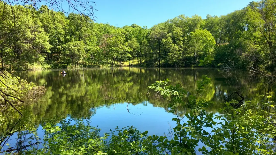
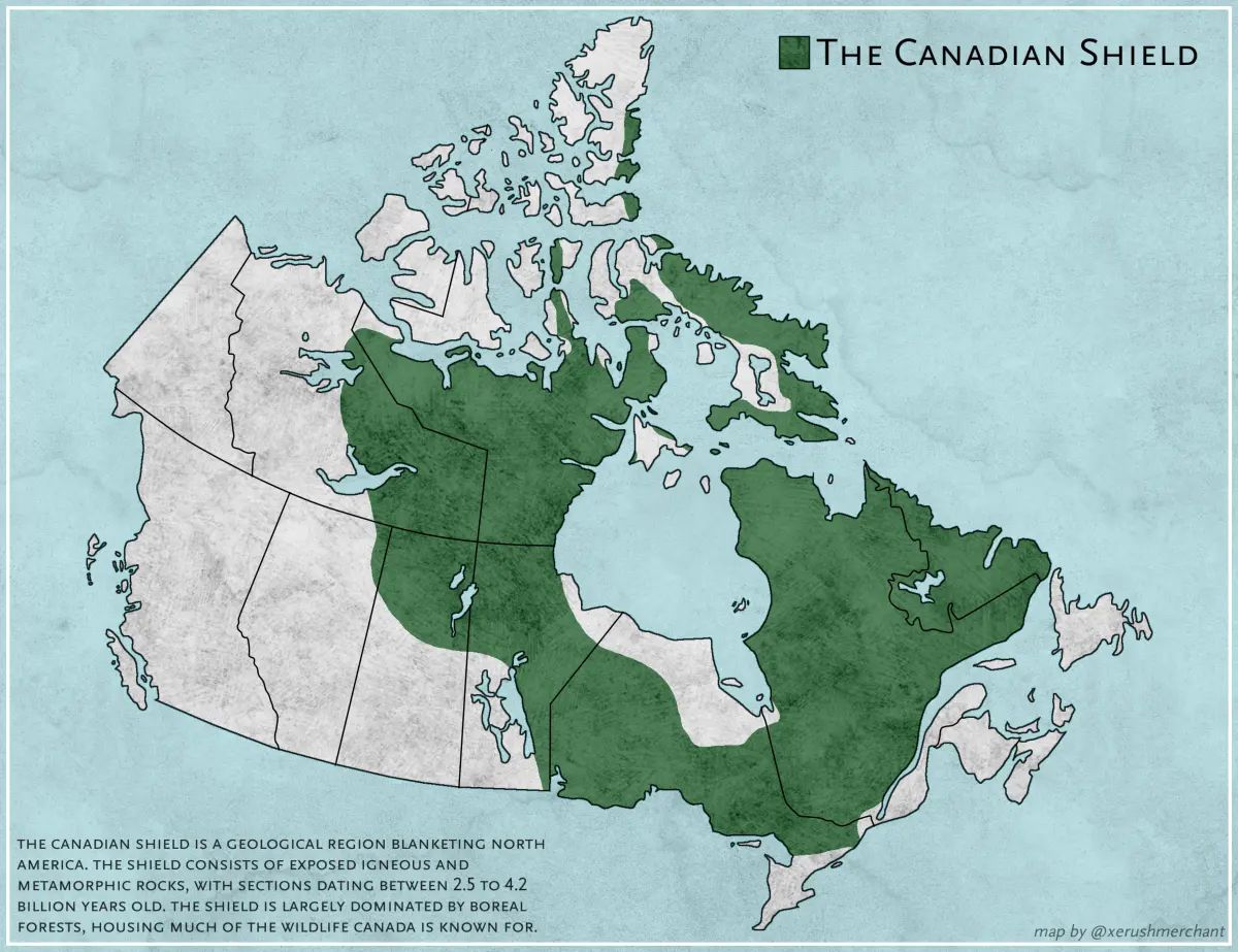
The Canadian Shield is a massive, horseshoe-shaped region of ancient Precambrian rock covering nearly half of Canada’s landmass. Spanning roughly 4.8 million square kilometers, this geological core consists of exposed igneous and metamorphic rock. It is characterized by thin, acidic soils, vast boreal forests, and thousands of freshwater lakes and rivers.
On this page
What is the Canadian Shield made of?
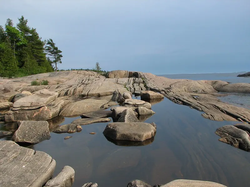
The Canadian Shield represents the exposed portion of the North American Craton, one of the oldest geological features on Earth. Its foundation consists of Precambrian rocks, primarily granite, gneiss, and schist, which formed between 1 billion and 4 billion years ago. These rocks were once part of massive mountain ranges that have been eroded over eons by wind, water, and glacial activity.
During the last Ice Age, massive glaciers scraped away the surface layers of soil and vegetation. This process left behind the rugged, rocky landscape seen today, characterized by rolling hills, deep basins, and exposed bedrock. The region is rich in mineral deposits, which are a direct result of the intense heat and pressure that originally formed the crystalline basement rock.
- Granite: The most common igneous rock found throughout the region.
- Gneiss: A metamorphic rock showing distinct banding from intense geological pressure.
- Schist: A foliated metamorphic rock often containing minerals like mica or quartz.
- Mineral wealth: Significant deposits of gold, nickel, copper, and iron ore.
Why does the Canadian Shield have so many lakes?
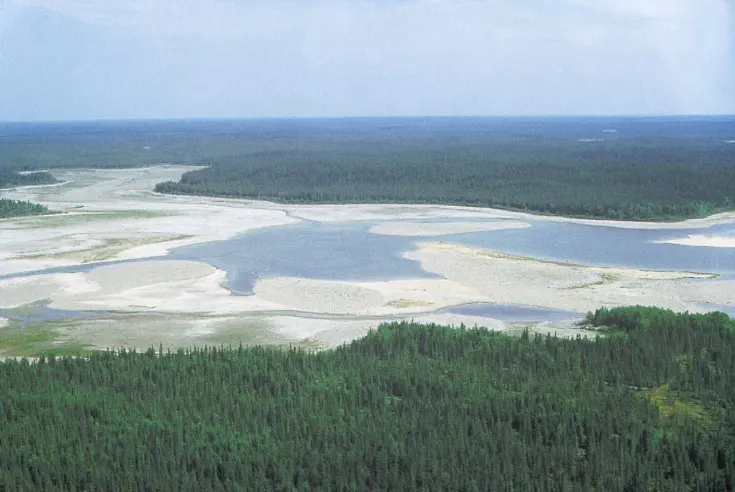
The abundance of water in the Canadian Shield is a direct consequence of glacial scouring. As the Laurentide Ice Sheet retreated roughly 10,000 years ago, it carved deep depressions into the fractured bedrock. These basins filled with meltwater, creating the millions of lakes and interconnected river systems that define the modern landscape of Northern Canada.
Because the bedrock is non-porous, water cannot easily drain into the ground. Instead, it collects on the surface, forming complex drainage patterns that cover vast areas of Quebec, Ontario, and the Northwest Territories. This unique hydrology makes the region a critical global reservoir for freshwater, supporting diverse aquatic ecosystems and providing a massive source of hydroelectric power for the country.
- Glacial erosion carves deep basins into the hard Precambrian rock.
- The retreat of ice sheets leaves behind meltwater that fills these basins.
- Poor soil drainage prevents water from sinking into the earth.
- Extensive river networks form, connecting the lakes to the ocean.
How do people travel across the Canadian Shield?
Traveling across the Shield requires careful planning due to its vast, sparsely populated nature. The terrain is dominated by dense boreal forests, wetlands, and rocky outcrops, which make building roads and railways exceptionally difficult and expensive. Most major transportation corridors are concentrated in the southern fringes, while northern travel often relies on air transport or seasonal winter roads.
If you are planning a trip through the Shield, you must account for the rugged geography and the limited infrastructure. Many remote communities are accessible only by floatplane or boat during the summer months. During winter, frozen lakes and rivers serve as temporary highways, allowing heavy equipment and supplies to reach isolated mining outposts and Indigenous settlements.
- Check local weather reports frequently, as conditions change rapidly.
- Ensure your vehicle is equipped for rough, unpaved terrain.
- Carry satellite communication devices, as cell service is non-existent in many areas.
- Respect the seasonal nature of winter roads, which are only safe when ice thickness is verified.
Common mistakes when exploring the Canadian Shield
One of the most frequent errors visitors make is underestimating the scale of the wilderness. The Shield is not a park; it is a vast, unforgiving landscape where help can be hundreds of kilometers away. Relying solely on GPS or digital maps is a mistake, as signal loss is common and batteries fail quickly in cold temperatures. Always carry physical maps and a compass.
Another common oversight involves the environment’s harshness, particularly regarding insects and weather. During the summer, black flies and mosquitoes can be overwhelming, necessitating proper protective clothing and high-quality repellent. Furthermore, travelers often fail to prepare for rapid temperature drops. Even in mid-summer, nights can become freezing, and sudden storms can turn calm lakes into dangerous, choppy waters for inexperienced paddlers.
- Assuming that all water is safe to drink without filtration or purification.
- Venturing into the boreal forest without adequate navigation skills.
- Underestimating the time required to travel between two points on a map.
- Ignoring the risks of hypothermia, which can occur even during warmer months.
How does the region impact Canada's economy?
The Canadian Shield is the economic engine of Canada due to its immense natural resources. It is home to some of the world’s largest mining operations, extracting vital commodities such as nickel, iron, diamonds, and gold. These resources are essential for global manufacturing and technology sectors, making the Shield a critical player in the international supply chain.
Beyond mining, the region’s geography supports a massive hydroelectric industry. The high elevation of the Shield, combined with its vast network of rivers and lakes, allows for the construction of large-scale dams. These facilities generate clean, renewable electricity that powers major cities across North America. The forestry industry also relies on the vast boreal timber reserves, though sustainable management practices have become increasingly vital to protect the region's delicate ecological balance for future generations.
Key facts
- The Canadian Shield is a massive geological formation covering approximately 4.8 million square kilometers, or nearly half of Canada's total landmass.
- It consists primarily of ancient Precambrian igneous and metamorphic rock, some of which dates back over 4 billion years.
- The region is characterized by thin, acidic soil, thousands of freshwater lakes, and vast boreal forests.
- It serves as a global powerhouse for mineral extraction, containing significant deposits of gold, nickel, copper, uranium, and diamonds.
- Visitors should avoid traveling during the peak black fly and mosquito season, which typically runs from late May through early July.
- When exploring the Shield, always carry a physical map and compass, as the region's vast, repetitive landscape often causes GPS signals to fail or batteries to drain rapidly in cold temperatures.
The bottom line
The Canadian Shield is the ancient, rocky heart of North America, forming the vast foundation upon which much of Canada is built. While its harsh climate and thin soil limit traditional agriculture, its immense mineral wealth and hydroelectric potential make it vital to the national economy. Understanding this rugged landscape is essential for anyone interested in the geological history and natural resources of the northern continent.
People also ask
How did the glaciers shape the Canadian Shield?
During the last Ice Age, massive glaciers scraped away the topsoil and carved deep depressions into the bedrock. This process created the thousands of lakes and rocky outcrops that define the region's current rugged topography.
Is the Canadian Shield suitable for agriculture?
Generally, no, because the soil is thin, acidic, and lacks the nutrients required for large-scale farming. Most human activity in the region focuses on forestry, mining, and hydroelectric power rather than traditional crop production.
What are the primary minerals mined in the Canadian Shield?
The region is one of the world's richest sources of base and precious metals. Major mining operations focus on nickel, copper, gold, iron ore, and diamonds, particularly in areas like Sudbury, Ontario, and the Northwest Territories.
Why is the Canadian Shield important for hydroelectricity?
The region’s abundance of lakes and rivers, combined with its steep elevation changes, provides ideal conditions for hydroelectric power generation. Provinces like Quebec and Manitoba rely heavily on these dams to provide renewable energy to millions of residents.
Can you find fossils in the Canadian Shield?
It is extremely rare to find fossils there because the rocks are primarily igneous and metamorphic, formed under intense heat and pressure. These geological processes destroy any organic remains that might have existed billions of years ago.
What kind of wildlife inhabits the Canadian Shield?
The vast wilderness supports diverse species including moose, black bears, wolves, lynx, and barren-ground caribou. The region also serves as a critical nesting ground for millions of migratory birds during the short northern summer.
This answer was created with the help of AI research tools and reference sources. Spotted an error? Let us know — we correct mistakes quickly. See our editorial policy.